Alan Godfrey Maps
Liverpool (Brunswick Dock) 1848-64
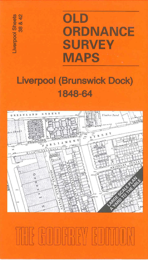
Code:Godfrey Map Number 38/42. This is another large scale map of the liverpool series. It covers the lower end of the coastal area housing the various docks and fits below the map of Wapping 1864 (Code 3257) It shows Queen’s Dock, Shipwright Yards, Manchester Old Quay, Chester Wharf, South Dock Yard, Brunswick Dock & Toxteth Dock. The housing inland is off Sefton Street (the coastal street) and inner streets are; Greenland St., Parliament St., Stanhope St., Perry St., Pleasant Hill St., Hill St. and Caryl St., It includes: Timber Sheds & Yards, General Stores, Cotton Stores, St Barnabas Church, Southern & Toxteth Hospital, South End Print Works, Borax Works, Harrington Lime Works, etc. On the reverse side of the map is a list of inhabitants on Hill St., Sefton St., Parliament St. and Stanhope St. extracted from Gore’s Directory 1855.